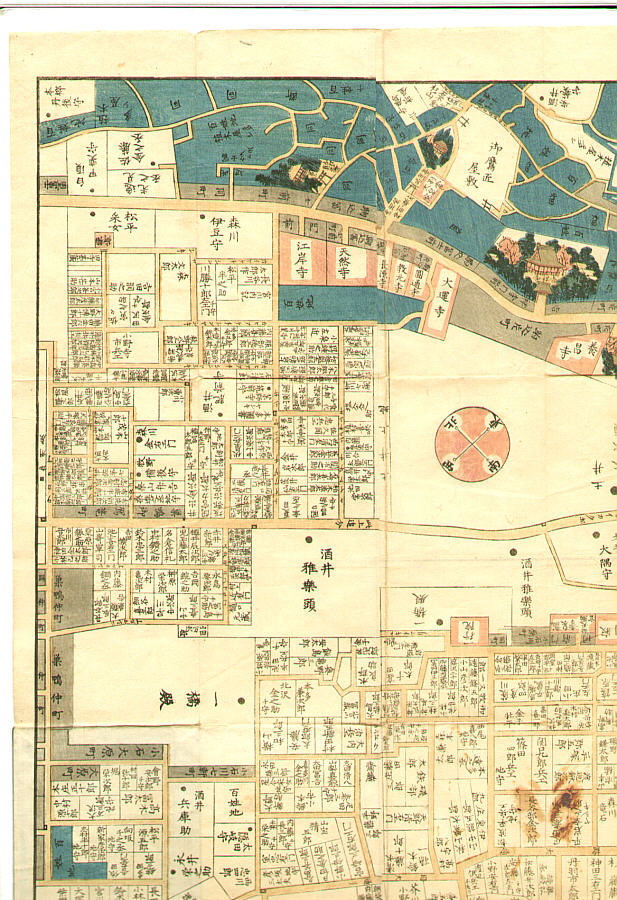
Japanese Print "Map of Komagome in Edo era - Owariya Edition" by Unknown
Artist:Unknown
Title:Map of Komagome in Edo era - Owariya Edition
Date:Originally 1857.
Details:More information...
Source:artelino - Japanese Prints
Browse all 24,751 prints...
Description:
"Owariya Ban Kiri-e Zu". The 31 folded maps of different parts of Edo, published one by one during 1850-1865 by Owariya. These were the maps people actually used to locate addresses. Red color indicates temple, shrine and Buddhist related areas. Grays are small housing areas. Larger houses have their family names indicated. Blue is farms and forests. This one is the map of Komagome area. Torii and Fuji-zuka (small Mt.Fuji) next to Ryumon-in, Kichijo-ji Temple, the medicinal plant garden.